 Viseum AI Surveillance Video Monitoring Software
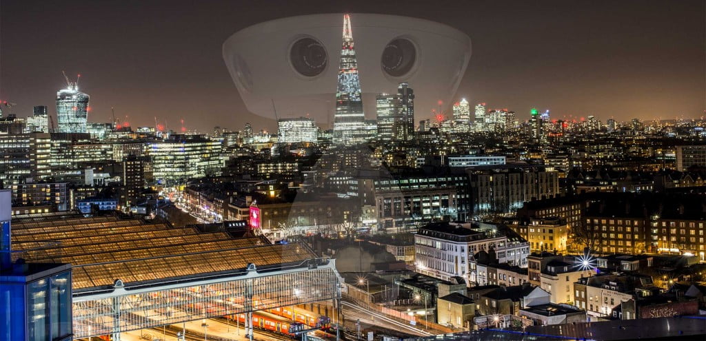
One Viseum camera does the work of 6 constantly manned cameras, a Metropolitan Police surveillance officer reported. Read the report
Safe City security and traffic management
Safe City is an initiative optimising the performance of all public services, making a city safe. A Viseum Safe City finds, fixes and follows incidents across a whole city automatically, and joins its control rooms to one national command centre. Human-centred decision support helps deliver a city’s routine and emergency security services. These constantly evolve using event logistics, detailed experiences and results. In practice, such big data proves invaluable, optimising costs and procedures to make a city safer from each lesson learned.

Global F3 Find, Fix and Follow
One suspect, from a plate read in a city to detention at a border. Each step is found, fixed and followed, and a person confirms before anyone acts.
See Viseum Global F3 Find, Fix and Follow
Read the step-by-step description
A suspect vehicle drives into City A, watched by Viseum 360-degree and fixed cameras, among ordinary traffic. The bar along the top shows the stage: find, fix, follow. The strip along the bottom names where we are (for example City A, Station, Main Street), with the camera or source that has the person and the time; once the view moves in, the inset in the top corner shows the whole city with a gold rectangle for the part in view. Four moments slow down and zoom in: the face captured through the windscreen while the car is held in queuing traffic at a junction, and identified against the watch-list as wanted; the operator confirming the match from the line of look-alikes; the person lost inside a building, every exit watched, and, after changing clothes inside, re-identified on the way out: a card shows the watch-list profile (red jacket) beside what camera 14 sees (grey jacket), and ticks face, build and height, the backpack and the phone data in turn, marks the jacket as changed, and updates the profile; and the switch to a new car, when a drone takes over. Find: the number plate is read on the move; it belongs to a white Nissan Patrol but the car is a black Toyota Camry, so the car is flagged. The crosscheck appears over the bottom right, so the map stays clear. Fix: on foot among people who look alike, the cameras turn to each look-alike in turn and score it as they look (violet circles); the closest scores are listed, and one best match goes to the operator, who confirms it. Follow: each camera hands over to the next with a gold token. Police are told at once, but in a crowded city they follow at a distance and wait for a safe place to stop the suspect, so the cameras keep the suspect in sight for them; the second half shows where that happens. When line of sight is lost, dashed routes run to the cameras the person could reach next; the route to the camera where they reappear turns solid and the others fade. Cameras cannot see through high-rise blocks, only along streets and across open spaces. Each source is shown on the map where its information comes from, and its place on the Global F3 ring lights as it reports: a public post placing them in the area, a database record of past events on this route, a shop's own camera, shared live with the city network under a registered partner programme (as Dubai's Oyoon programme links private-sector cameras) and matched by the suspect's profile, the phone mast whose network data, where lawfully provided, places them inside the building, the vehicle crosscheck of the new car, and the drone. On the right, each source lights as it reports, the match level rises and falls with what is known, the newest finding sits at the top and command control shows which alerts went out. At the end the whole route is drawn in gold and the car, with the drone above it, leaves City A at the edge of the map. The match levels and scores shown are examples. Command control shows how each alert is used: the operator's alarm and the video wall in the control room, the patrol's handheld app (live view, photo and route) and the police radio for the officers on the ground, and the case file, which keeps every image and finding as evidence.
The suspect then drives away. In a slow moment at the city limit, the drone, which flies over City A only, hands the car to the first highway camera with the usual three beats (the drone glows, a gold token passes, the camera glows) and turns back. The same city then pulls out into its place on a simplified map of a real coastline and border, with no real names. Between the highway's cameras the car is unseen, so Global F3 weighs four possibilities, each drawn as a dashed blue route: the car hides in City A, or it heads for City B, the airport or the border crossing. City A's control room watches its parking areas and garages for the hiding case, and the profile, face and plate are sent ahead to the other three. Each possibility is then settled in turn: the plate read at City B rules out hiding in City A; the airport sighting confirms that route; no sighting back in City B rules City B out; and the border crossing is where the suspect is detained. The bars on the right show where the suspect could be, and the clocks show the journey time and the time since they were last seen. Each re-identification is a slow moment: the view slows down and zooms in. On the coastal highway at the edge of City B, a number-plate camera reads the car's plate in moving traffic (the plate is shown masked); staying in City A falls away and the route to City B turns solid. City A's control room then hands the case to City B's: the first glows, a green token travels between them along a green dotted control room link, the second glows, and the label in the corner of the map changes to the control room now in charge. At the airport entrance, where the airport runs live watch-list matching as Gulf airports do, the suspect is re-identified by face and profile against the authorised watch-list and an operator confirms, and police are sent from inside the terminal, but before they reach the entrance the suspect is back in the car and drives away, still followed by the cameras. With no sighting back in City B, the possible routes narrow to the inland road and the case is handed to the border control room. At the checkpoint the face and the plate are matched against the watch-list, an officer confirms, the lane barrier stays closed, and two officers detain the suspect at the booth and lead him away. He never crosses. Because he was heading for the neighbouring country, its police are then told through INTERPOL, in case accomplices or others are waiting for him on their side; nothing is tracked there. Finally the whole journey is drawn, solid gold where a camera saw the suspect and gold dots where it was worked out, with each hand-off marked by a gold diamond, and the panel sums up the sightings, hand-offs and elapsed time. Throughout, the overview in the corner shows where each close-up sits, and the strip along the top names the place. What each source on the Global F3 dial adds: Vehicles reads every plate and finds that this one belongs to another car; Face confirms the person, and an operator checks every match; Social media, checked under lawful authority, places the person on a street from a public post; Knowledge databases (police records) show the route was used before, so the system predicts where they go next; Partner cameras, a shop’s own cameras shared with the police, keep the follow going; Mobile networks, where lawfully provided, confirm the person is inside a building; and Drones follow from above when the person drives away. The match scores, plate digits and journey times shown are examples.
One control room for a whole country
An operator works an alert through a guided procedure. Control rooms, city masters and a national centre then link up, with a hot backup at every level.
See Viseum Video Management System
Read the step-by-step description
The view opens on one control room's video wall: nine screens, each a different live alarm scene from the diagrams above (an object found by the Viseum AiRadar, a face confirmed in the camera network, the suspect's car handed from city to city, a person re-identified in the city, a crossing attempt stopped at the border, a drone over a protected site, the plate mismatch sent to the UVSS, the wanted passenger matched in the check bay, and the watch-list alert at the border), with the alerts list beside it. Any screen with an alert is lit in gold, and each alert opens an incident with a guided procedure that the operator follows step by step: the alert is raised and prioritised, an operator accepts it, the right cameras and the map are brought up, the operator verifies it (a false alarm is closed and logged here), a responder is sent with the live view, it is escalated if needed, and it is resolved and logged for review. The view then pulls back: the wall shrinks into its control room on the map, and every other control room in the country comes into view, each drawn as a small, sharp copy of a wall. The network is drawn as a tiered design. Each of three cities has a city master command centre and a backup master on hot standby in a separate area, and its district control rooms report to the master (dashed blue lines are the backup links). Along the land border, the sector controls report to a border master, which also has a backup. Only the masters report to the national command centre, which has its own backup, and they send up only high-risk alarms. Information pulses along the links, each room reporting at its own moment, while people are followed from city to city and each control room they reach lights up in gold. The view then moves into the national command centre, whose wall shows only a few high-risk alarms live, with a status light for every site beneath, and calls up more video on demand (no centre streams every room at once); into one of those screens, which is the first control room's wall; and on into one remote site's live view, before zooming back out to the wall, and the whole sequence runs again without a break. Every zoom takes the same time with the same easing, and every view is held for the same time between zooms.
“This camera saves lives protecting our city and perimeter.” (City Governor, Middle East War Zone)

Also, places where many people gather are targets for crime, disorder and attacks on crowded places. These areas have always been the most technically problematic to deliver security. The Viseum UK Group introduces advanced technologies as trusted plug-and-play solutions. With the technical performance and reliability of our security solutions, we produce the most effective city security and surveillance to protect citizens and visitors to towns and cities.

 The Safe City concept gives a government one plan for protecting its people, its roads and its critical assets.
Learn More »
Viseum UK is managing an increasing number of Safe City projects throughout the world. Our delivery processes have been optimised to run in parallel with the design of your city’s security. The same applies to the delivery of your initial order and your security infrastructure’s initial training and integration. The first installations will deliver security for the city’s highest-risk areas (pedestrian crime and traffic safety hotspots), where the results will show how the system works in practice. Your training and pilot installation process can also be completed in synchronisation with your agreed citywide deployment schedule.
Completely Automated Safe City Security, Face Recognition Video Analytics and Social Media Investigations.

National Security and Safe City Presentation
Why governments choose Viseum for Safe City
Viseum is the only AI surveillance technology provider in the world to successfully meet the UK Government’s latest National CCTV Strategy Recommendations. All types of AI surveillance cameras available today, other than Viseum, miss crucial video information; a Viseum camera follows each incident close up, in every direction at once.
- Designed to harmonise all security assets of a video surveillance enterprise.
- Optimising all new and existing legacy video surveillance cameras.
- Optimise first responders: automatically detect and follow people when searching for persons of interest (manhunt).
- Governments and security agencies maintain intelligence databases and watchlists of persons of interest. We would start by looking for the most wanted people in the city.
- For each threat, we agree the automated detection scenario, then the best first responding service and action.
We can equip and train your teams with the most advanced and future-proof technology.
The UK National CCTV Strategy
This report sought Viseum’s innovation to overcome the widely recognised problems with both new and legacy video surveillance systems. “Viseum exceeds these recommendations in both specification and innovation.”
The Viseum UK Group brings the security industry its newest technologies as trusted plug-and-play systems.
Unique Safe City funding option
Viseum UK has evolved a unique way of funding Safe Cities from traffic enforcement revenue. This uses the world’s only fully automated and multitasking security and surveillance cameras, with benefits that governments and local authorities endorse and that others fund:
- Some communities contribute through traffic fines and benefit from enhanced city security.
- Some subscribe to the feel-good factor of city security and benefit from safer roads.
A typical major city has more than 10 traffic violation hotspots, where only Viseum technology can optimise the policing of traffic violations. For example, Viseum automatically manages road violations and provides the unique group-shared surveillance service, Viseum Community SafetyWatch. With a projected $200 million for every 200,000 subscribers, the scale planned for a typical country franchise over five years, subscribers pay for this service as they pay for energy, communications and insurance, and it brings them safety as part of the same bundle of services.
Popular Information for Viseum Safe City:
 Public safety regulations for surveillance now hold governments to account for the cameras they buy and the results they deliver.
Learn More »
 Viseum counters crime and terrorism. Viseum cameras protect the places where many people gather, finding, fixing and following incidents automatically.
Learn More »
 Viseum’s safe city report shows how one camera that sees every direction at once changes the security of a city.
Learn More »
 Places where many people gather are targets for crime, disorder and attacks on crowded places.
Learn More »
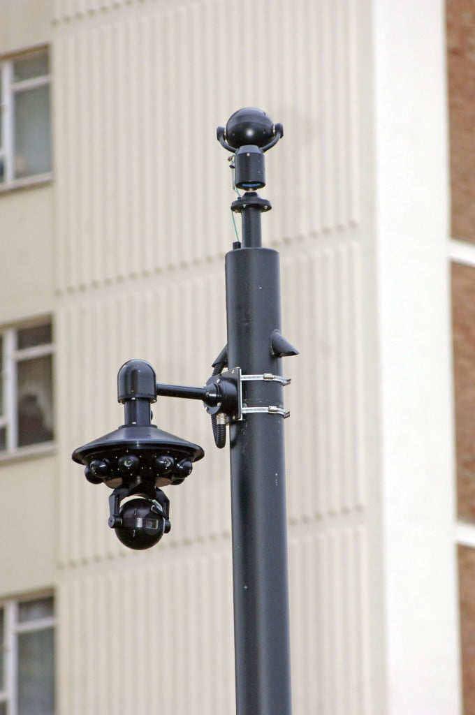 Every surveillance camera installation we deliver follows one internationally regulated process. First, we survey the site and agree measurable security goals.
Learn More »
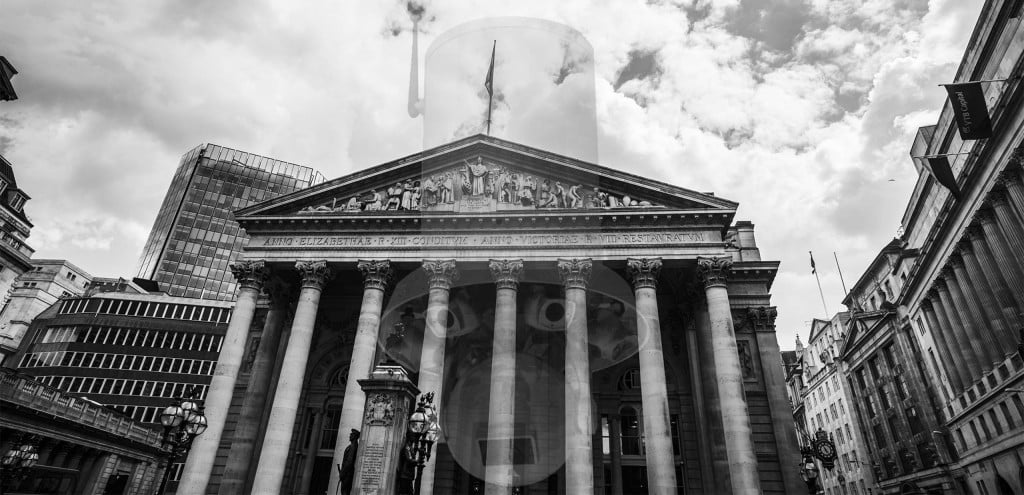 This council surveillance savings calculator works out the yearly saving when AI situational awareness replaces extra cameras and operators.
Learn More »
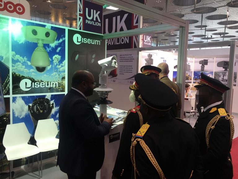 Captures 100 times more faces. Over 25 x more usable video. Clears up over 15 x more incidents.
Learn More »
 The Viseum traffic enforcement camera covers more road from fewer cameras and processes more traffic violations automatically, with fewer staff.
Learn More »
 Viseum’s multitasking camera automates security and revenue-generating traffic management. This was a Safe City Camera training day using our Face Recognition Software Technology Services and Social Media Investigations.
Learn More »
 Public safety is now a priority for governments across the world. The 26/11 Mumbai attack made that clear.
Learn More »
 Publicised installations of Viseum’s Safe City Performance.
Learn More »
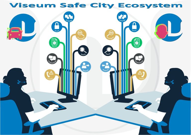 The Viseum safe city ecosystem combines automated security with traffic management. Viseum cameras protect the places where many people gather, finding, fixing and following incidents automatically.
Learn More »
 Viseum Community SafetyWatch is already on its way to every continent. It is growing into the world’s largest surveillance network.
Learn More »
 Public safety must be the first priority for any authority seeking smart city status, and Viseum builds it into the camera.
Learn More »
 This safe city reference material collects press coverage of Viseum’s Safe City work. Viseum UK’s lead with the international Safe City initiative has proven so successful that many journalists have interviewed the Viseum UK Safe City Team and published these findings.
Learn More »
Safe City questions governments ask
What is a Safe City?
A Safe City uses surveillance, data and command and control to make public services work together, so crime, disorder and emergencies are found and answered faster.
What is the best Safe City camera?
The Viseum 360 Security Camera. One Viseum camera does the work of 6 constantly manned cameras, a Metropolitan Police surveillance officer reported. It covers up to the size of 4 Olympic stadiums and follows each incident itself.
Smart City or Safe City first?
Safe City first: residents, businesses and investors judge a smart city by whether its streets feel safe.
More in Featured Projects
 Military Drone Defence
 Safe Cities
 Missile Detection System
 Border security cameras
 Safe City
- Counter Drone System
 Traffic Enforcement Camera
 Airport Surveillance
 Critical infrastructure security cameras
 Construction Site Security Cameras
 Gated Community Security Systems
 Riot Police and Riot Control Cameras
- See everything in Featured Projects
Viseum Safe Cities PSIM
More videos
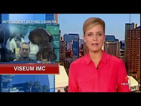 Viseum AI camera on TV
 Viseum Technology Credentials
 One UK market example
 Radar detection 2004
Project delivery and savings
Our Sales Network
Security Industry Sectors
Complete Change in Sales Strategy
What happens after you contact Viseum
A specialist reads your project questionnaire for a commercial review and checks it against projects we have already delivered.
We arrange a live demonstration, either online from your own desk or on your site with a Rapid Deployment trailer.